
Maps and graphics online
TUfind – Search Portal of ULB
TUkart – Digital collection of maps of ULB
Old maps of Hessen (opens in new tab) with around 400 maps
Fachinformationsdienst Kartographie und Geobasisdaten (FID Karten)
A short journey through the collection
-
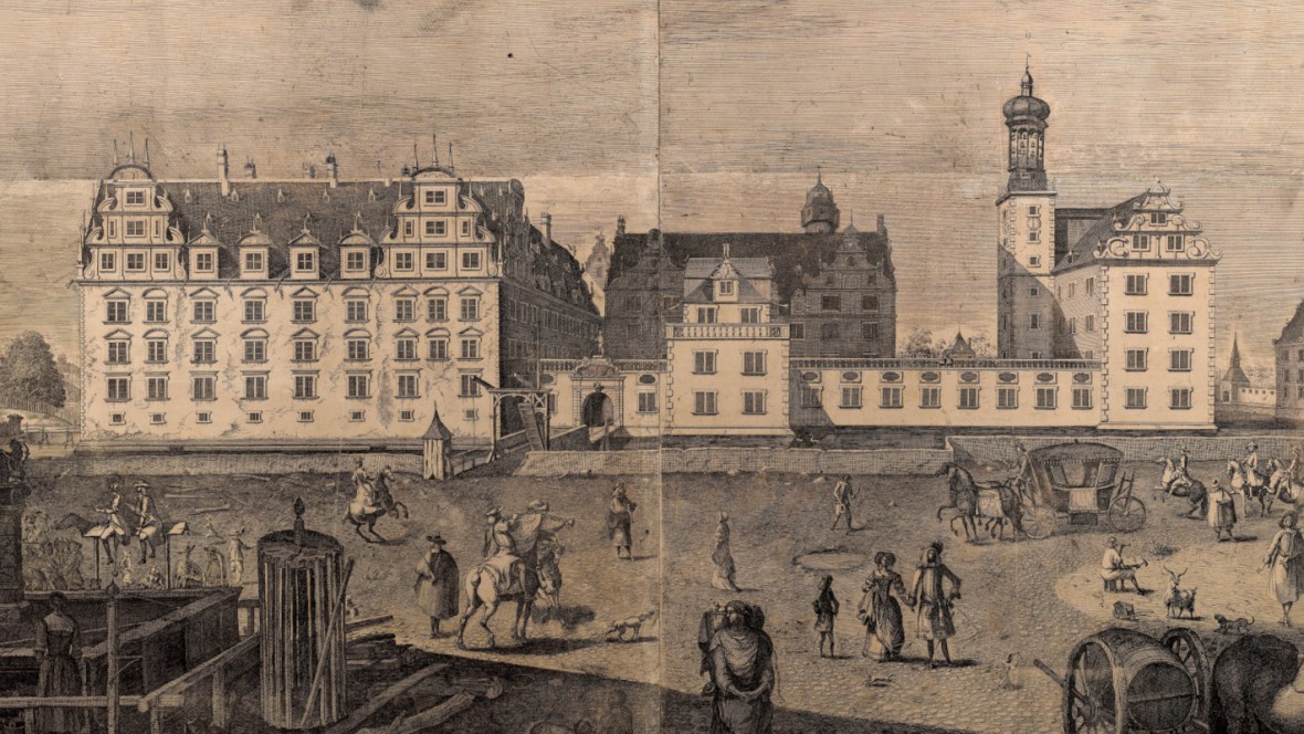
![Residenzschloss 1676 - Rodingh, Pieter | Ansicht 3494a (TUdigit)]()
Residenzschloss 1676 – Rodingh, Pieter | Ansicht 3494a (TUdigit) -
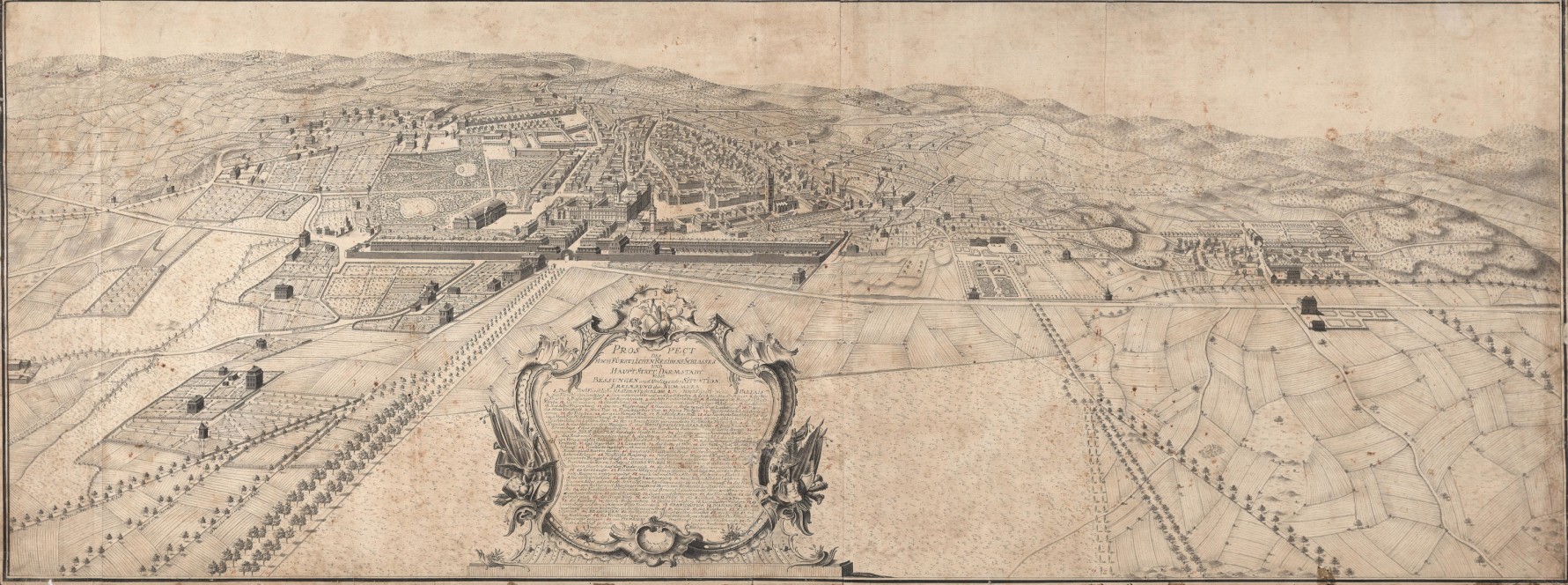
![Prospect des Hochfürstlichen Residens Schlosses und Haupt Statt Darmstadt nebst Bessungen 1775 - Hill, Johann Jakob | Mappe 001/16 (TUdigit)]()
Prospect des Hochfürstlichen Residens Schlosses und Haupt Statt Darmstadt nebst Bessungen 1775 – Hill, Johann Jakob | Mappe 001/16 (TUdigit) -
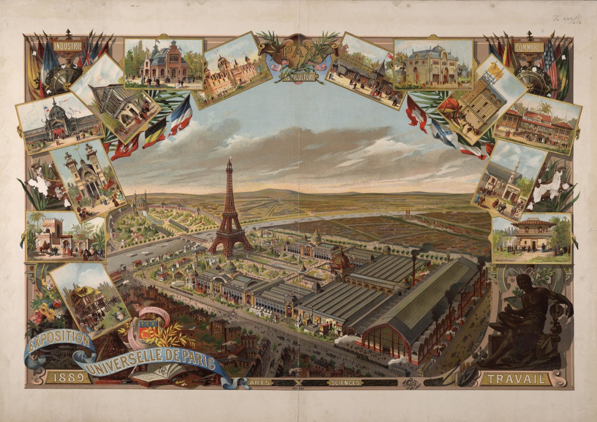
![Exposition Universelle de Paris 1889 | H 443/406 (TUdigit)]()
Exposition Universelle de Paris 1889 | H 443/406 (TUdigit) -
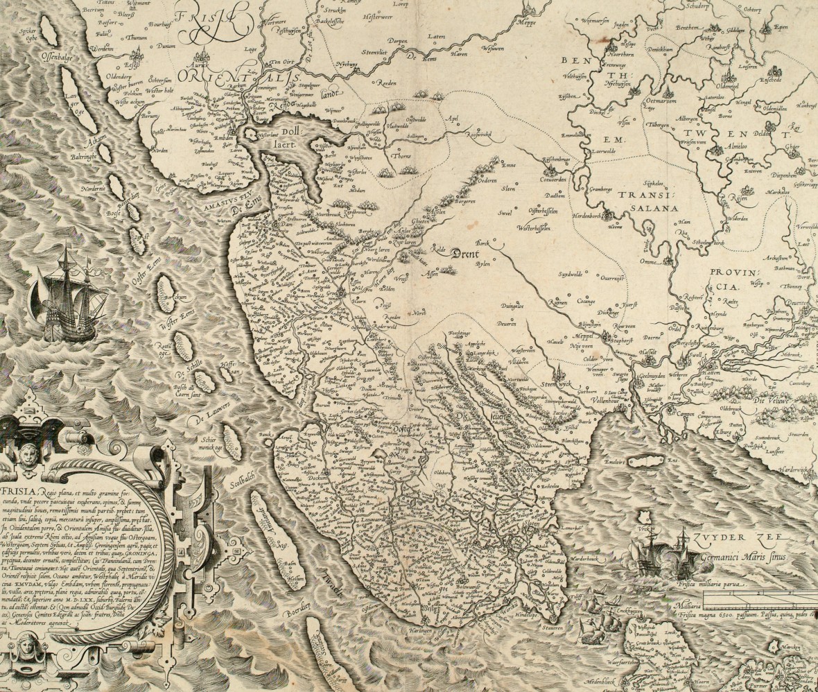
![Frisia 1571 - vermutlich Hogenberg, Franz | LK 1986/05 (TUdigit)]()
Frisia 1571 – vermutlich Hogenberg, Franz | LK 1986/05 (TUdigit) -
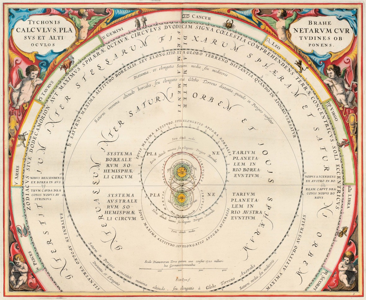
![Atlas Coelestis seu Hamonia Macrocosmica (Himmelsatlas), 1660 - Andreas Cellarius | gr. fol. 3/497a]()
Atlas Coelestis seu Hamonia Macrocosmica (Himmelsatlas), 1660 – Andreas Cellarius | gr. fol. 3/497a -
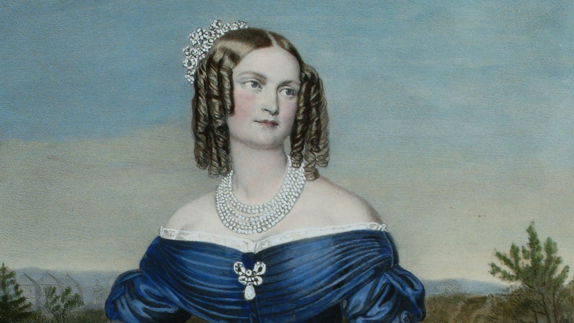
![Porträt der Großherzogin Mathilde, 1840 - Hartmann, Joseph | P Hessen 76 (TUdigit)]()
Porträt der Großherzogin Mathilde, 1840 – Hartmann, Joseph | P Hessen 76 (TUdigit) -
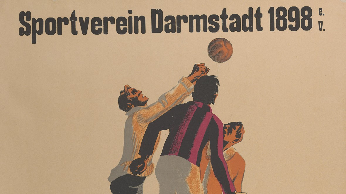
![Plakat Sportplatzweihe Sportverein Darmstadt 1898 e.V. 1921 - Eschle, Max | Plak 1/14 (TUdigit)]()
Plakat Sportplatzweihe Sportverein Darmstadt 1898 e.V. 1921 – Eschle, Max | Plak 1/14 (TUdigit) -
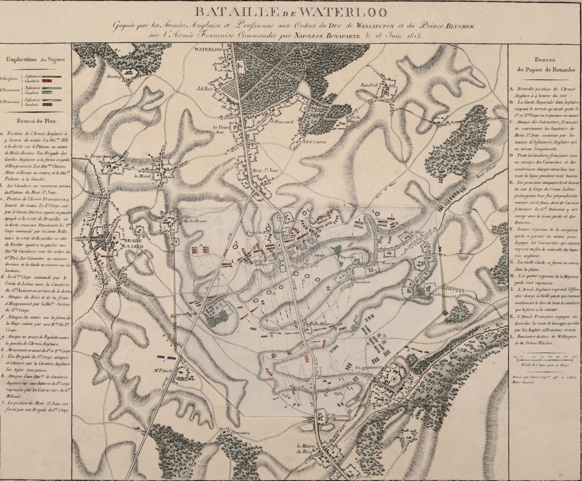
![Bataille de Waterloo 1815 - de Salucci, Giovanni | K 5417]()
Bataille de Waterloo 1815 – de Salucci, Giovanni | K 5417
- Go to picture 1
- Go to picture 2
- Go to picture 3
- Go to picture 4
- Go to picture 5
- Go to picture 6
- Go to picture 7
- Go to picture 8