Georeferencing of Historical Maps

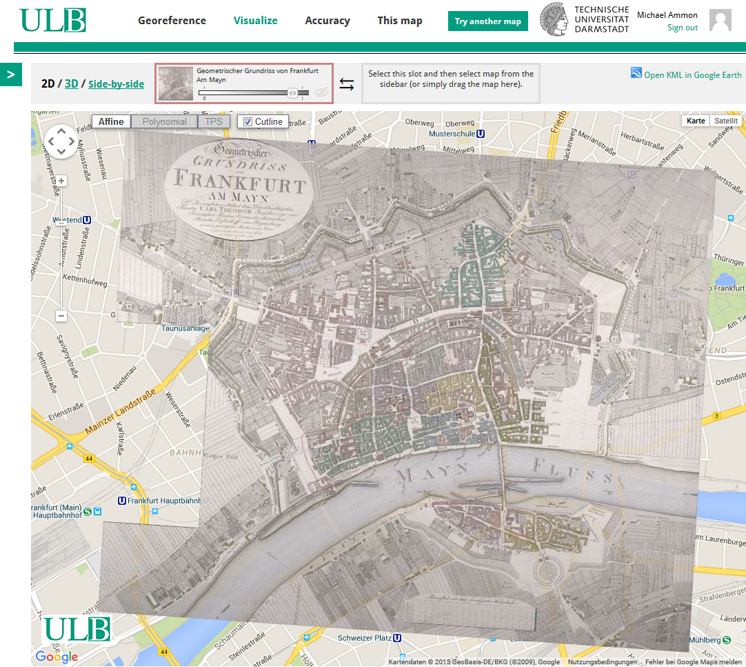
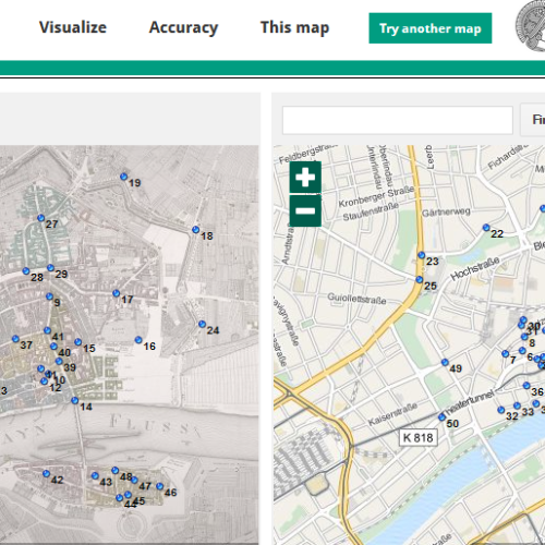
Assigning control points to digitised maps (georeferencing) allows old maps to be compared with modern ones.

Picture: ULB Darmstadt

Become a georeferencer

In this project, which was launched in 2015, 75 people linked 886 maps with more than 20.000 control points in under five weeks. And the work continues – become a georeferencer and link digitised maps.

The quick start guide or straight to the detailed instructions (opens in new tab) (german version only)

  • Log in to ULB georeferencer with an existing social media account (Twitter, Facebook, Google) or create an account.
  • Select “Try another map”. A random map will be displayed. The historical map will be shown on the left and the modern one on the right.
  • Compare the two maps. Identify the area that is depicted. Use “Find a place” or go to “This map” for further information on the map.
  • Select identical control points on the two maps by clicking on them alternately. Mark as many points as possible, including beyond the edges of the map
  • Use “Clip” to cut out the map area (video tutorial).
  • Then click on “Save”.
  • Check the displayed location on the map. If necessary, correct the control points. Add more control points or edit the next map.